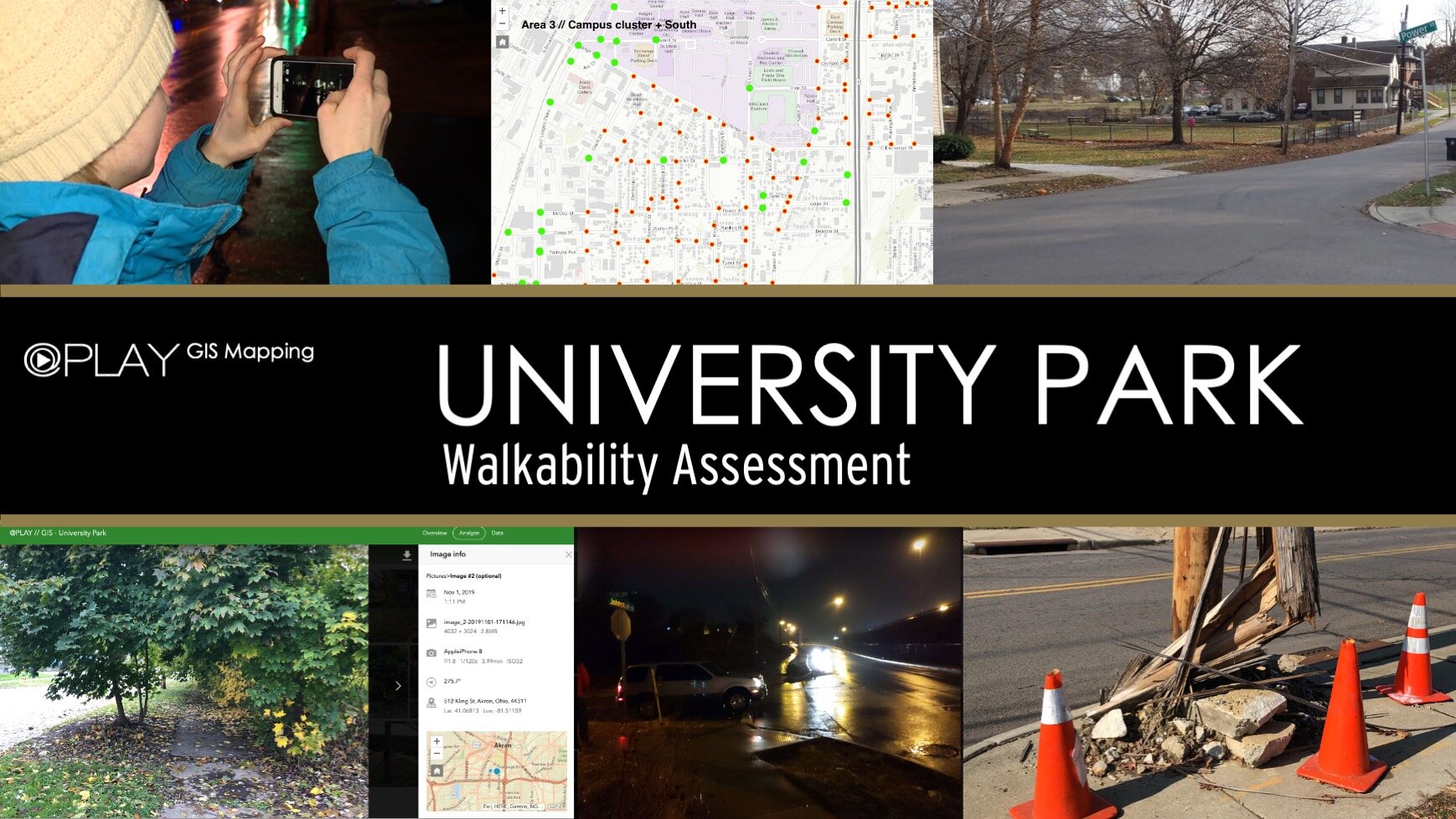
University Park GIS
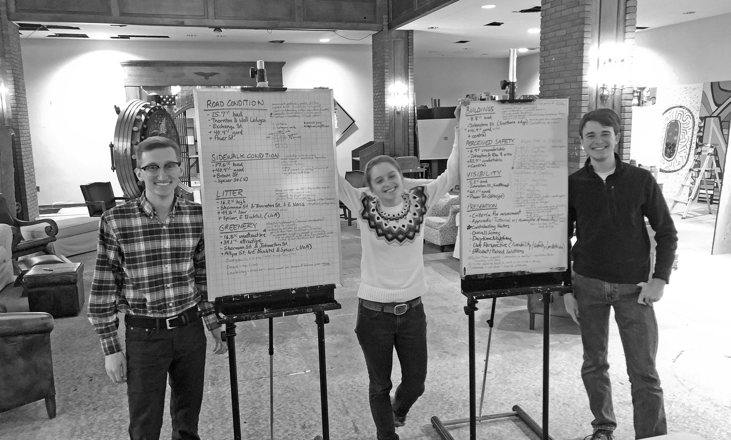
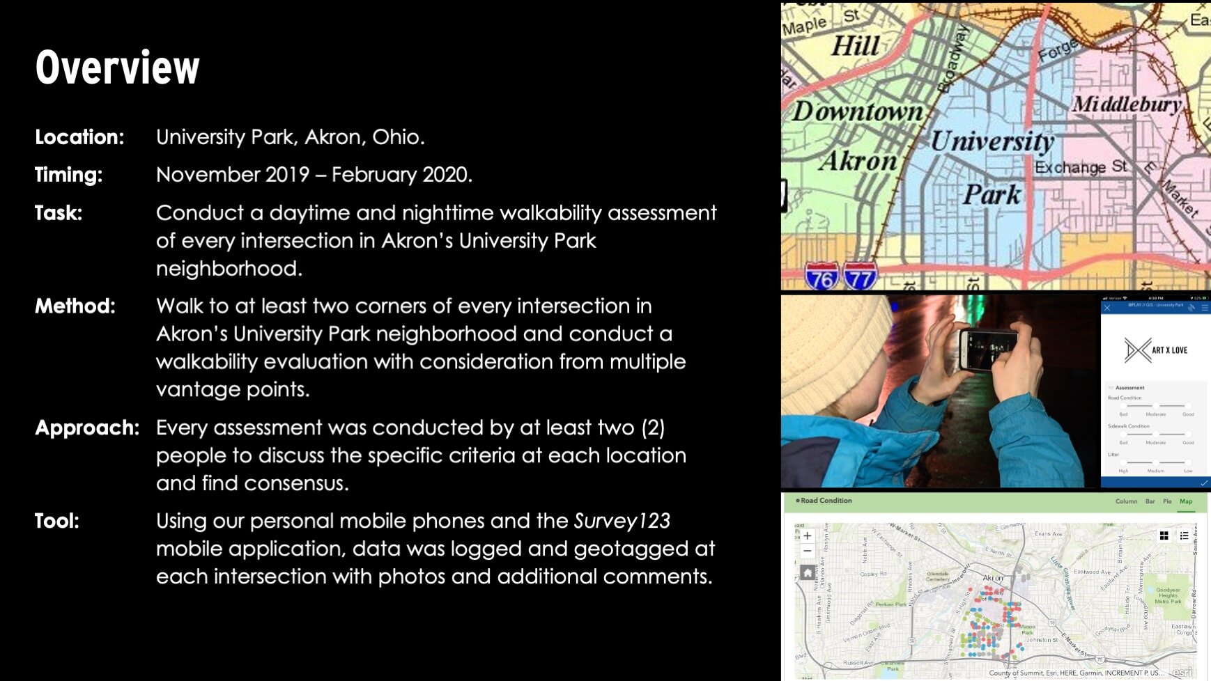
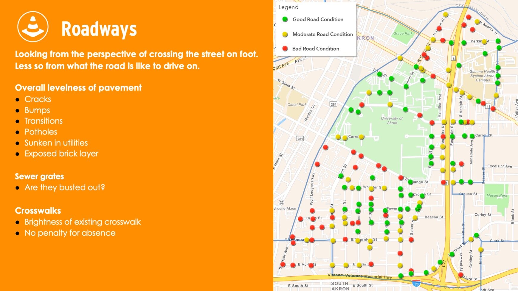
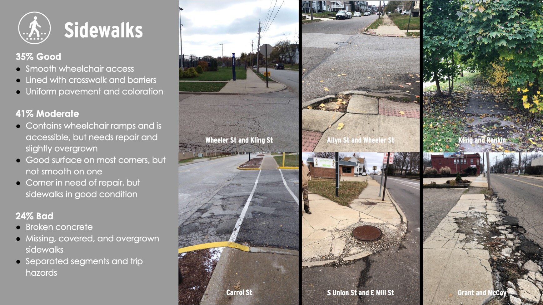
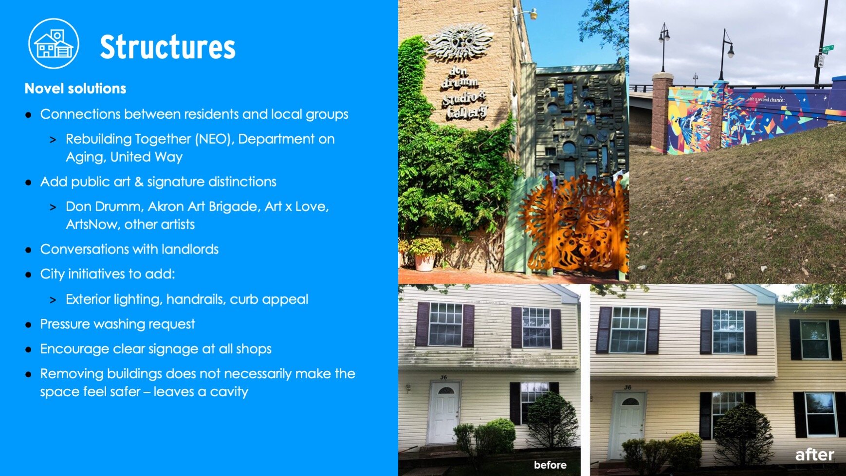
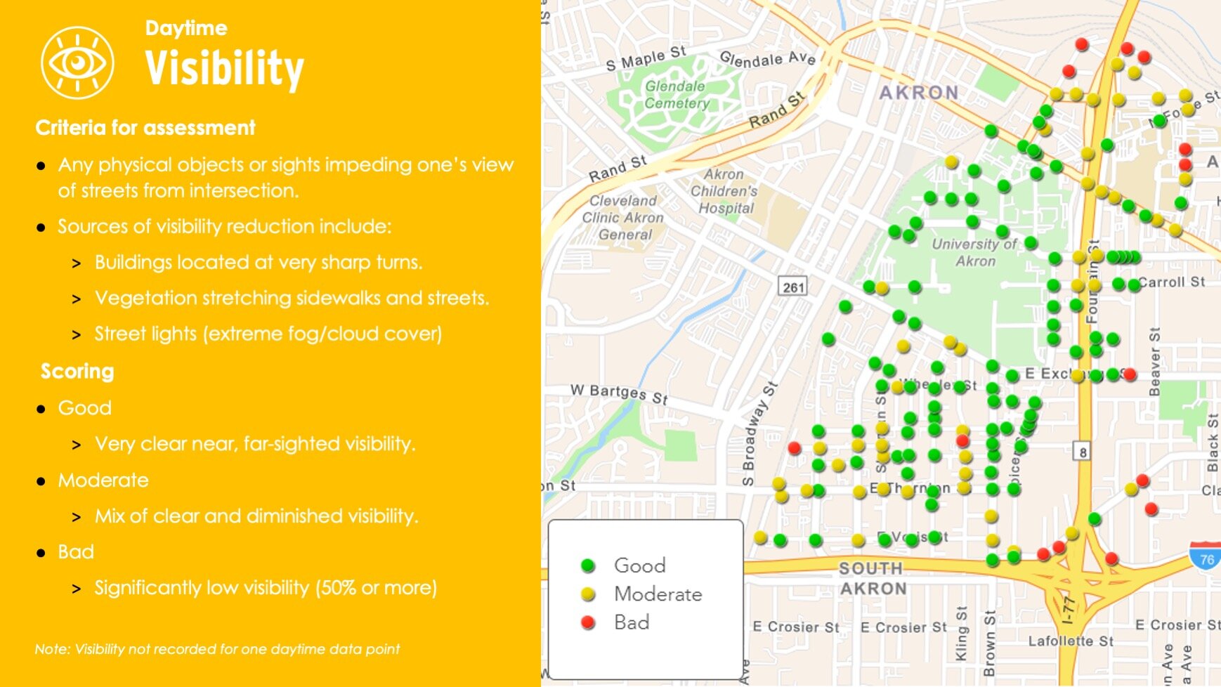
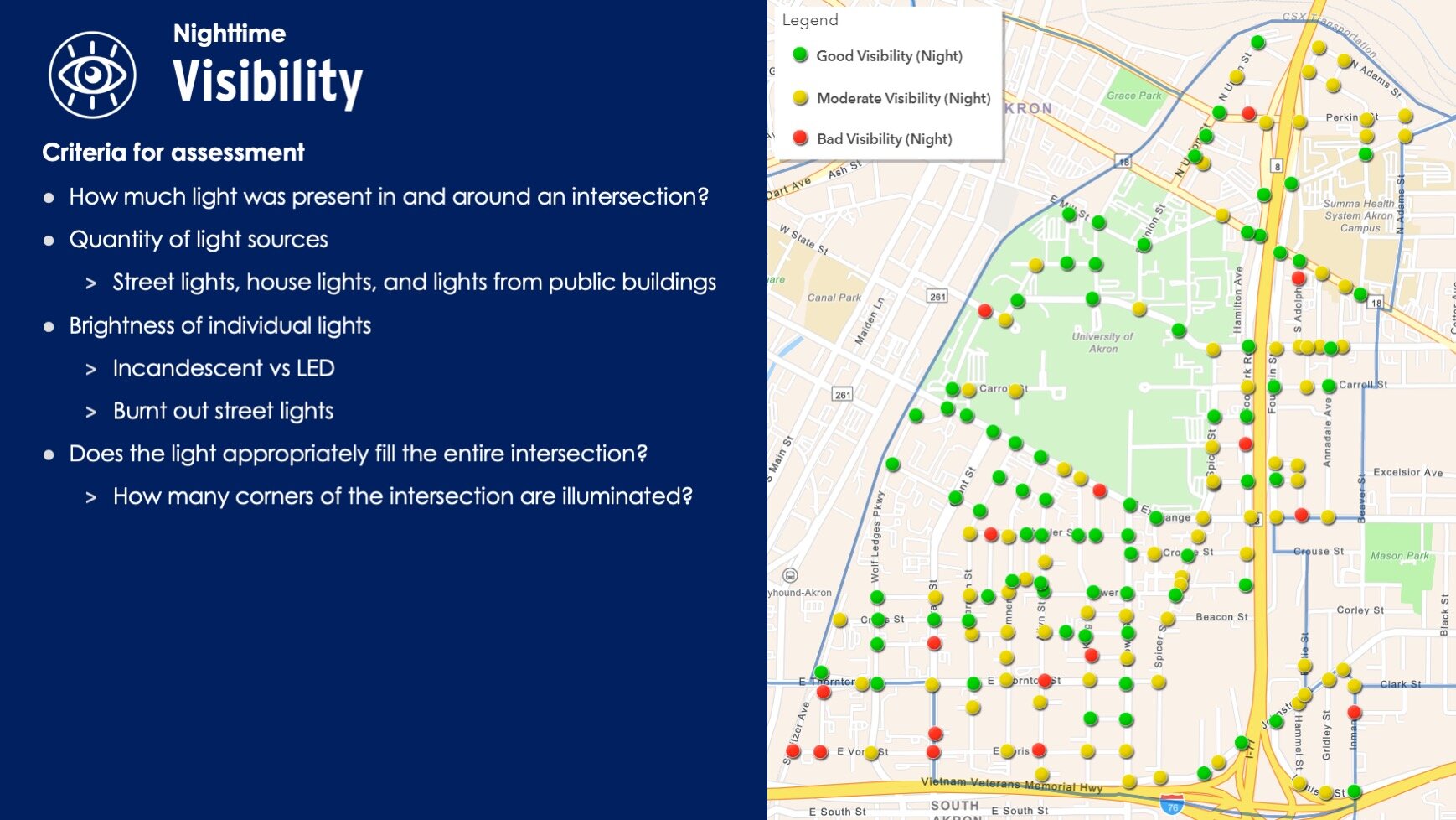
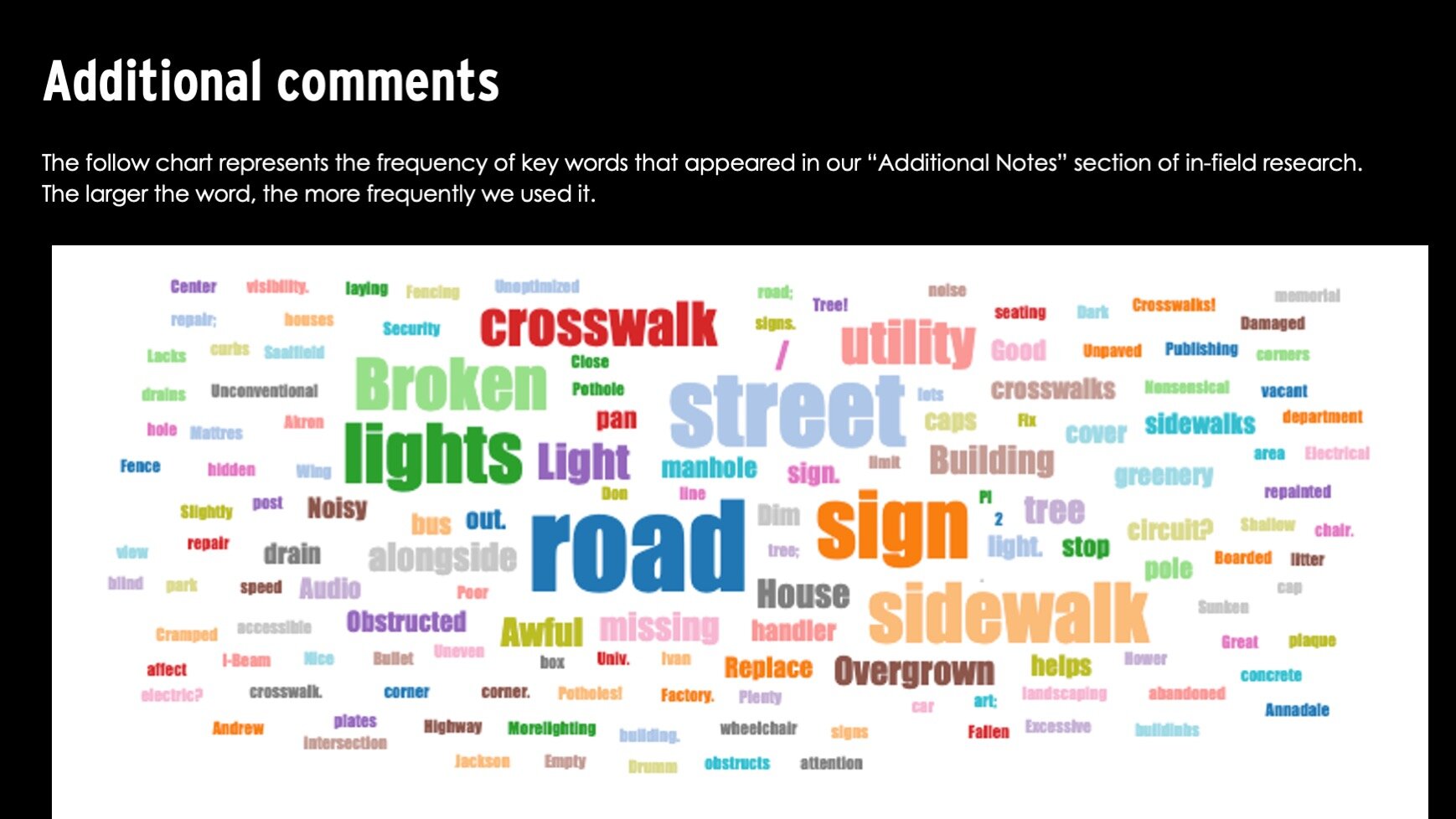
Art x Love partnered with volunteers from the University of Akron’s Engineering Services Design Team (ESDT) to create a daytime & nighttime Walkability Assessment of Akron’s University Park neighborhood using a geographic information system (GIS). The team walked every intersection of the neighborhood at day and night, and used the Survey123 application on their mobile phones to log walkability data about roadways, sidewalks, litter, greenery, structures, visibility, and perception of safety.

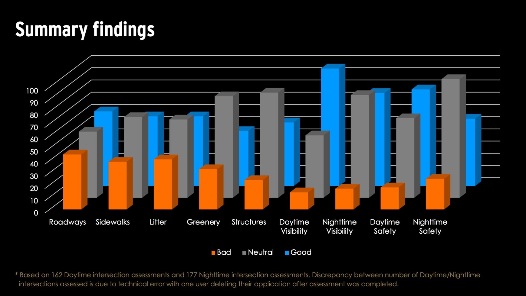
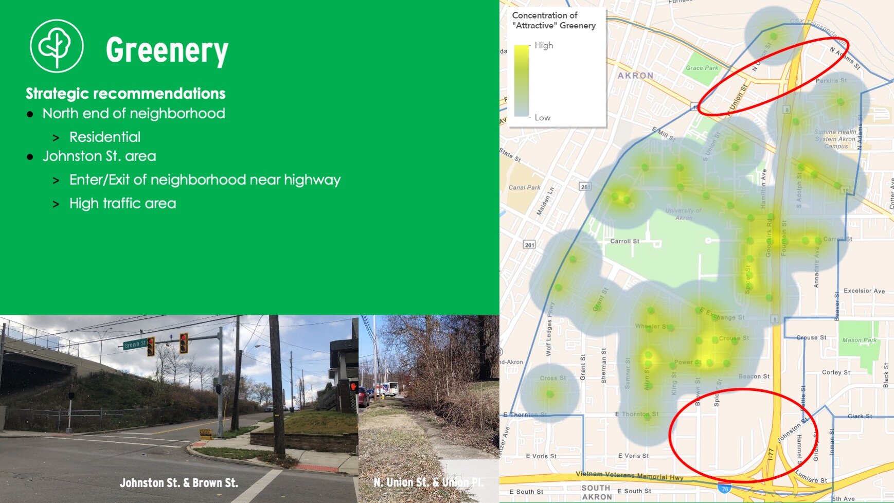
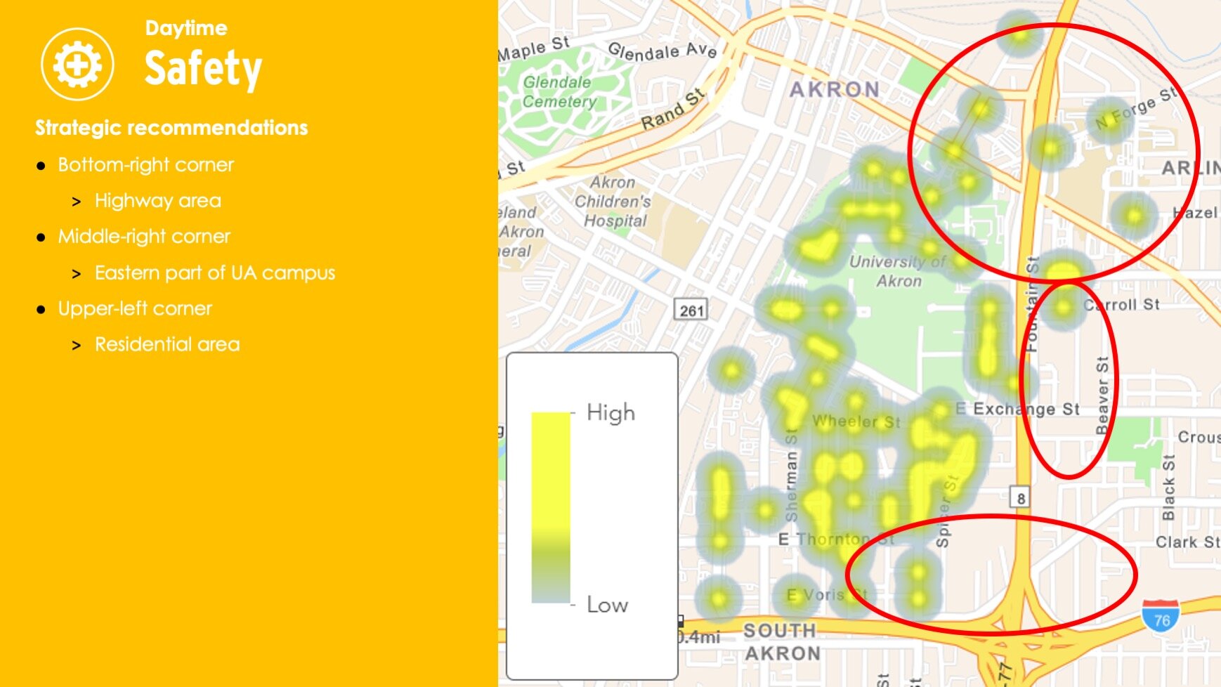
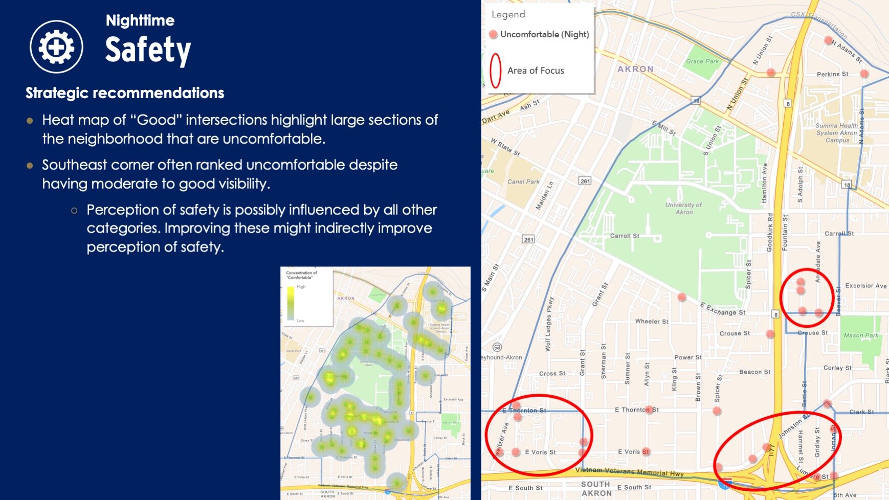

The data was compiled and analyzed to provide targeted insights and recommendations to improve walkability and neighborhood perception. The team shared its findings with the City of Akron’s GIS & Cartography department, City Arborist, and members of the Office of Integrated Development.
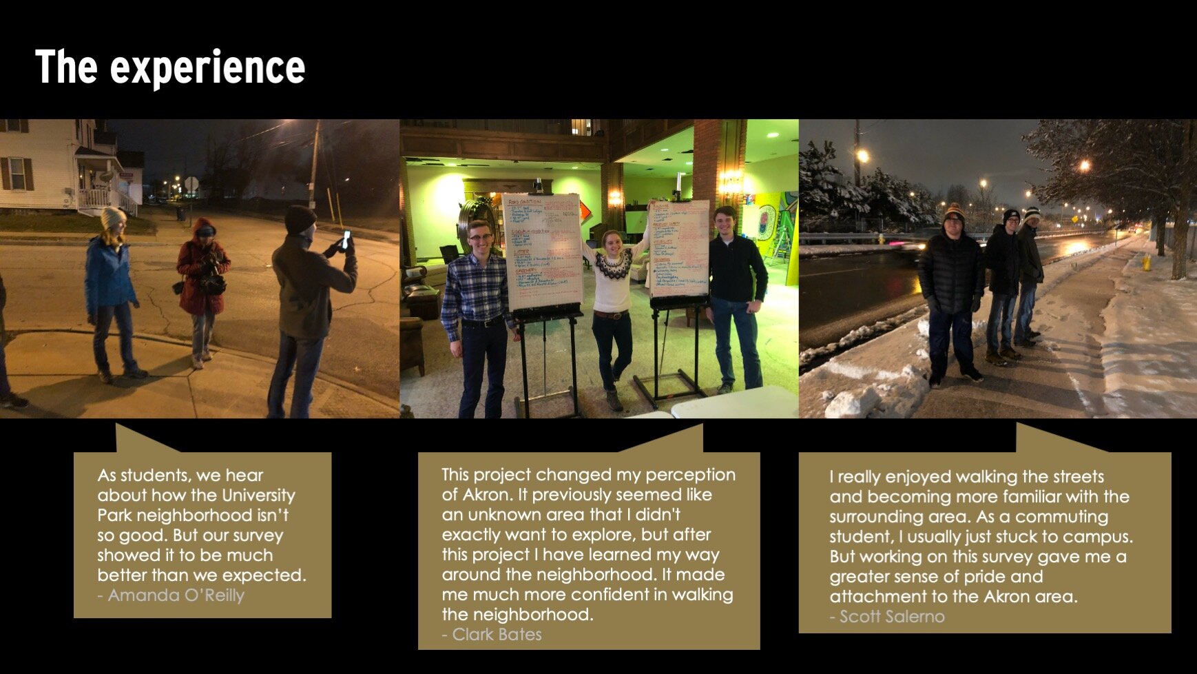
Through Art x Love’s @PLAY GIS process, University students reported a greater appreciation for the diversity and quality of the neighborhood. An executive summary of the team’s findings, including specific reports on key features can be provided upon request.