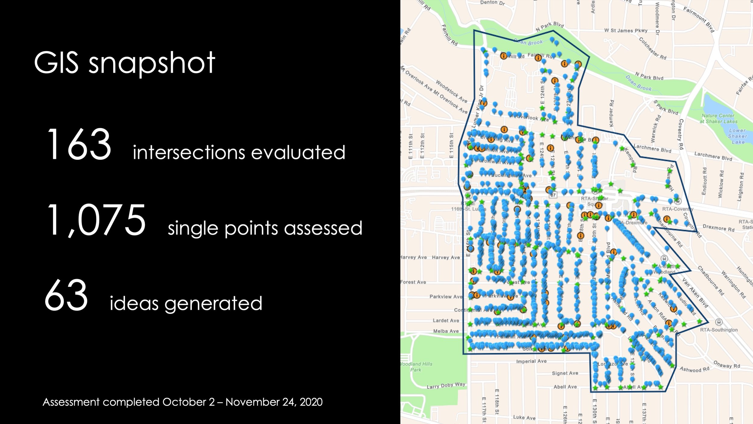
Buckeye-Shaker GIS
Charting a course for systemic change.
Art x Love taught students and residents geospatial analysis (ArcGIS) and mapped every sidewalk and intersection in Cleveland’s Buckeye-Shaker neighborhood. We assessed the condition of roadways, sidewalks, structures, greenery, litter, visibility, perception of safety, and pinpointed ideas for improvement. This data has mobilized residents, guided new partnerships, and is informing transformational investments.
Steps to Equity was selected as the opening presentation on Equity & Social Justice at the 2022 Esri User Conference in San Diego, CA.